

crewind041122-2
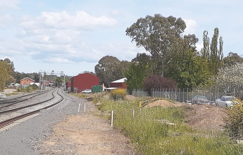
2022 This modern image was taken from as close to the original as possible and shows the station in the distance with the one remaining goods shed. Since 1872 virtually the entire rail corridor to the west or right of the main line has been filled in and built up to the level of the railway line. In recent times, structures have been built on this raised area to support the Castlemaine – Maldon Railway project, and the buildings can be seen in this image. This infilling of the land has in fact created a gigantic levee bank on the eastern side of Barkers Creek and where once any flooding would have spread to the east and the west of the creek, nowadays it has only one way to go, and that is the west bank of the creek in Gingell Street where flooding frequently occurs.
crewind041122-2
2022
This modern image was taken from as close to the original as possible and shows the station in the distance with the one remaining goods shed. Since 1872 virtually the entire rail corridor to the west or right of the main line has been filled in and built up to the level of the railway line. In recent times, structures have been built on this raised area to support the Castlemaine – Maldon Railway project, and the buildings can be seen in this image. This infilling of the land has in fact created a gigantic levee bank on the eastern side of Barkers Creek and where once any flooding would have spread to the east and the west of the creek, nowadays it has only one way to go, and that is the west bank of the creek in Gingell Street where flooding frequently occurs.